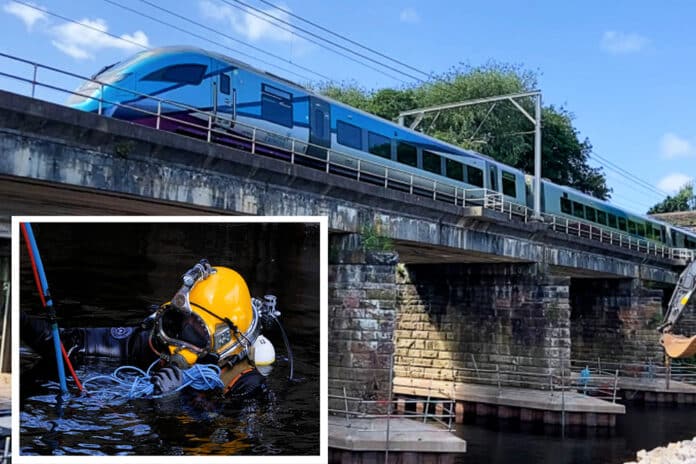
Railway engineers have been working to protect three viaducts from river erosion in Cumbria.
Strong currents in the River Eden were causing the underwater foundations of three railway viaducts to be gradually washed away:
- A 1940s-built concrete structure carrying goods lines on the West Coast main line in Carlisle
- A Victorian-built viaduct directly next to that which passenger trains use, and
- Long Meg viaduct on the Settle to Carlisle line.
Since summer 2021 Network Rail has invested £5.1 million to protect the three structures.
Network Rail teams used detailed hydrographical surveys* of the riverbed to plan the essential maintenance.
They showed how over time the water had ‘scoured’ away the viaduct supports.
Heavier rainfall in recent years brought about by climate change was also speeding up the scour at an alarming rate.
As a precaution trains on the West Coast main line structures were forced to run at reduced speeds of 20mph.
Due to working in the river, Network Rail worked very closely with the Environment Agency and Natural England to ensure construction methods had the least impact on wildlife as possible.
This included the development of a special mix of environmentally safe ‘non leach’ concrete, which was pumped underwater into the gaps of the West Coast main line structures by professional divers.
Huge boulders known as ‘rock armour’ were also placed in the water to divert river flow around the viaduct supports – known as piers – at all three structures.
The work took place in two stages – temporary repairs in summer 2021 – and a final fix in summer/autumn 2022.
In the most recent phase of work during 2022:
- 1,850m3 or 4,000 tonnes of special setting concrete was poured
- 5,000 tonnes of boulders or ‘rock armour’ were positioned in the river
- 16,800 hours of work took place
All work was completed in time for winter when heavy rainfall causes river levels to peak.
Engineers have been to the sites in recent weeks to monitor the fast water flows and the upgrades are working exactly as intended.
It’s allowed all speed restrictions to be lifted so trains can run at full line speed of up to 100mph, meaning faster journeys for passengers and freight operators.
Rob Stephens, Network Rail principal route engineer, said: “Now the winter rains are once again swelling the River Eden our vital work to protect the three railway viaducts is being put to its first big test and it’s great to see our improvements protecting rail passengers and freight trains.
“These projects have been challenging and have blended technological and engineering innovations alongside traditional techniques. Using new technology will be crucial as we make the railway more resilient from severe weather and our changing climate in future.”
For more information on how Network Rail maintains viaducts and bridges visit: https://www.networkrail.co.uk/running-the-railway/looking-after-the-railway/bridges-tunnels-and-viaducts/
*A hydrographical survey – sometimes call a bathymetric survey – uses a lightweight remote-controlled boat to send GPS or echo sounders between it and the riverbed to measure the distance. These are then recorded and build up a three-dimensional underwater map of the terrain which can be converted into a computer model. This allowed teams to plan exactly how much material was needed to secure the viaducts’ underwater foundations. The success of the surveys of the riverbed mean this has now been adopted as standard to investigate other cases of significant river scour on railway structures.
Photo and video credit: Network Rail


 0113 2082620
 info@railbusinessdaily.com
 15 Mariner Court, Wakefield WF4 3FL

